

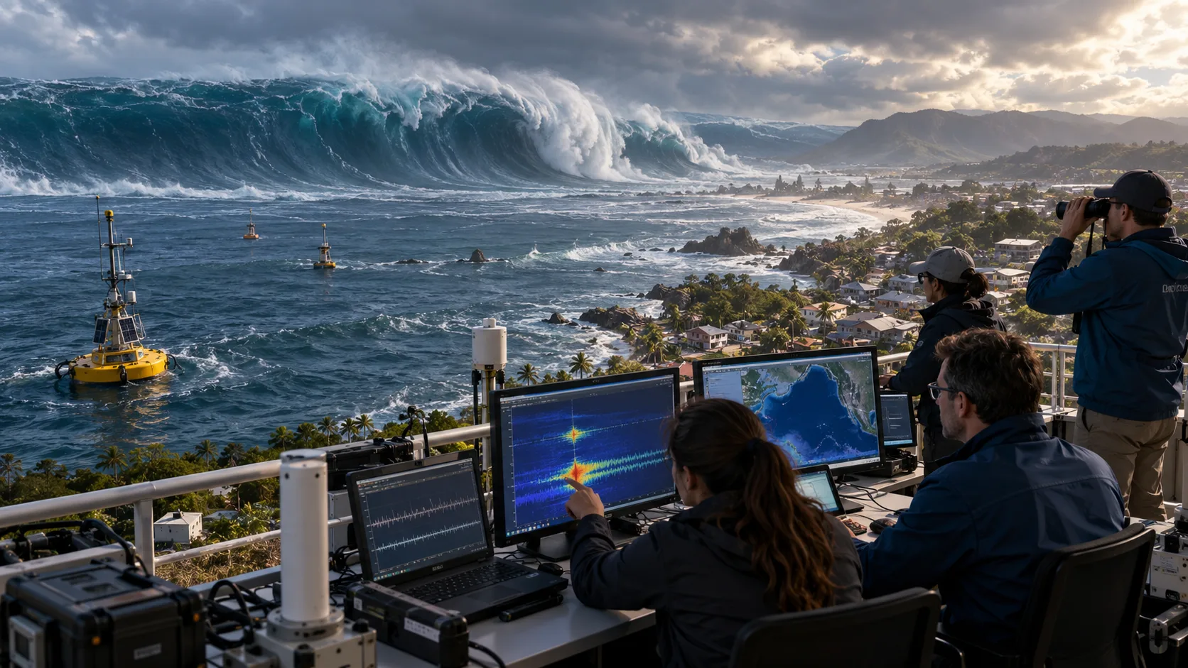
Tsunamis are among the most powerful natural disasters on Earth, capable of sending enormous volumes of ocean water toward coastal communities. Unlike ordinary waves created by wind, tsunamis develop when a large amount of water is suddenly displaced by an underwater earthquake, volcanic eruption, or landslide. These events can generate waves that travel across entire oceans and cause serious flooding when they reach land.
Understanding what causes tsunamis and how scientists predict them is important for learning about natural disasters and coastal safety. Although researchers cannot predict exactly when a tsunami-generating earthquake will happen, modern technology helps detect dangerous events and forecast possible coastal impacts. This article explains the science behind tsunami formation, how waves travel, and the warning systems used to protect vulnerable communities.
What Is a Tsunami and How Does It Form?
A tsunami is a series of long ocean waves generated by the sudden displacement of a large volume of water. This movement usually begins when the ocean floor shifts during a powerful earthquake, pushing the water above it out of its normal position. Gravity then works to restore balance, creating waves that spread outward from the disturbance.
Unlike everyday ocean waves, which mainly affect water near the surface, tsunami waves involve movement through much of the water column. Their wavelengths can extend across enormous distances, allowing them to transport energy throughout ocean basins. In deep water, the waves may be barely noticeable to ships despite carrying significant energy toward distant coastlines.
The word tsunami comes from Japanese and means harbor wave, reflecting the destructive effects these events can have near shorelines. Tsunamis are sometimes incorrectly called tidal waves, although tides do not cause them. Understanding this difference is important because tsunami formation depends on sudden water displacement rather than normal gravitational changes associated with ocean tides.
How Underwater Earthquakes Cause Tsunamis
Underwater earthquakes are responsible for most major tsunamis, particularly those occurring near tectonic plate boundaries. Earth’s outer shell consists of large plates that move slowly over time, sometimes becoming locked together along faults. When accumulated stress is suddenly released, the resulting earthquake can shift the seafloor and displace the water above it.
Subduction zones are especially important because one tectonic plate moves beneath another in these regions. Large earthquakes along these boundaries can cause sections of the seafloor to rise or fall suddenly. This vertical movement pushes or pulls the overlying water, generating long waves that travel away from the earthquake’s location.
Not every underwater earthquake produces a tsunami because the direction, depth, and amount of seafloor movement matter. Earthquakes that mainly involve horizontal movement may displace less water than those producing substantial vertical movement. Scientists therefore examine several earthquake characteristics before estimating whether a dangerous tsunami may have formed.
Can Volcanic Eruptions and Landslides Trigger Tsunamis?
Volcanic activity can generate tsunamis when an eruption or related event suddenly moves large quantities of ocean water. Possible mechanisms include underwater explosions, collapsing volcanic slopes, and rapid movements of volcanic material into the sea. The size of the resulting waves depends on the disturbance and surrounding water conditions.
Underwater landslides are another important cause because large masses of sediment or rock can move rapidly across the seafloor. As this material shifts, it displaces surrounding water and may generate dangerous waves. Similar events can occur when cliffs or mountainsides collapse into coastal waters, lakes, or narrow bays.
Some landslide-generated tsunamis are especially dangerous near their source because waves can reach nearby shorelines with little warning. Scientists study unstable slopes, geological deposits, and previous landslide events to understand these hazards. However, identifying a potentially unstable area does not mean researchers can predict exactly when a collapse will happen.
Why Do Tsunami Waves Travel So Fast?
Tsunami waves travel differently from ordinary wind-generated waves because their speed depends strongly on water depth. In deep oceans, tsunami waves can move at speeds exceeding 800 kilometers per hour, comparable to a passenger aircraft. Their long wavelengths allow energy to move efficiently across large distances without producing dramatic surface heights.
As a tsunami approaches shallower coastal waters, its speed decreases because the wave interacts more strongly with the seafloor. The water energy becomes concentrated into a shorter horizontal distance, often increasing wave height. This process helps explain why a relatively small disturbance at the ocean surface can become hazardous near land.
Coastline shape, seafloor features, and local water depth all influence how a tsunami behaves when approaching shore. Narrow bays and certain harbors may concentrate wave energy, increasing local water movement. Consequently, the same tsunami can produce very different effects along neighboring coastal communities, making accurate forecasting particularly challenging.
What Happens When a Tsunami Reaches the Coast?
When tsunami waves reach shallow coastal waters, they may rise significantly and produce powerful currents that move inland. However, a tsunami does not always resemble a towering breaking wave commonly shown in movies. It may instead appear as a rapidly rising flood or unusually strong surge of water.
The resulting flooding depends on wave energy, coastal elevation, underwater terrain, and the shape of the shoreline. Low-lying communities may experience extensive inundation, while nearby elevated areas can remain above the floodwater. Harbors, river mouths, and coastal channels can also experience hazardous currents even when wave heights appear relatively modest.
Tsunamis usually arrive as a series of waves rather than a single event, and the first wave is not necessarily the largest. Dangerous conditions may continue for several hours as additional waves and powerful currents arrive. This is why official safety instructions remain important even after the initial water movement appears to have passed.
Can Scientists Predict When a Tsunami Will Happen?
Scientists cannot currently predict the exact time, location, and size of an earthquake that might generate a tsunami. Earthquakes involve complicated geological processes that cannot be monitored precisely enough to provide reliable advance predictions. Therefore, forecasting a tsunami before its triggering event occurs remains beyond the capabilities of modern earthquake science.
However, scientists can identify regions where tsunami-generating earthquakes are more likely over long periods. Geological research, historical records, and tectonic plate observations help researchers understand which coastal areas face significant hazards. These assessments support emergency planning and construction decisions, but they are not predictions of specific future events.
Once a potentially dangerous earthquake occurs, scientists can rapidly estimate whether it may have produced a tsunami. Monitoring systems then provide observations used to forecast wave movement and possible coastal impacts. This distinction between predicting an event beforehand and forecasting its effects afterward is central to understanding modern tsunami science.
How Scientists Detect Underwater Earthquakes
Seismometers are sensitive instruments that record ground movement caused by earthquakes and other geological disturbances. Monitoring networks positioned around the world collect seismic information and transmit it to scientific agencies. These observations help researchers determine where an earthquake occurred, how large it was, and whether its characteristics suggest possible tsunami generation.
Earthquake waves travel through Earth’s interior much faster than tsunami waves move across the ocean. This speed difference allows monitoring centers to receive earthquake information before a potential tsunami reaches many distant coastlines. Scientists can therefore begin issuing preliminary warnings while continuing to examine the available seismic data.
Earthquake magnitude is important, but it is not the only factor used to assess tsunami potential. Researchers also consider earthquake depth, location, fault movement, and proximity to the ocean. Combining these observations helps warning centers distinguish between earthquakes that are more likely to generate dangerous waves and those presenting less tsunami risk.
How Tsunami Warning Buoys and Ocean Sensors Work
Deep-ocean monitoring systems play an important role in confirming whether a tsunami has actually formed. One widely used technology is the Deep-ocean Assessment and Reporting of Tsunamis system, commonly called DART. These monitoring stations measure changes in water pressure near the seafloor that can reveal unusually long waves moving through the ocean.
A typical DART system includes a bottom pressure recorder and a surface buoy that helps transmit information. The underwater equipment detects small pressure changes, while communication technology relays observations to tsunami warning centers. Scientists use these measurements to confirm wave activity and improve estimates of the tsunami’s movement and potential impact.
Coastal tide gauges provide another valuable source of information by recording changes in sea level near harbors and shorelines. Although originally designed for monitoring tides, these instruments can also detect tsunami arrivals. Combining coastal observations with deep-ocean measurements helps scientists understand how waves develop as they approach different locations.
How Computer Models Forecast Tsunami Movement
Computer simulations are essential for forecasting how a tsunami may travel across an ocean and affect different coastlines. These models use information about the triggering event, ocean depth, coastal elevation, and observed wave measurements. Researchers combine these inputs to estimate wave arrival times, water heights, and possible flooding in vulnerable areas.
Bathymetric data, which describes the underwater shape of the ocean floor, is particularly important in tsunami modeling. Deep trenches, continental shelves, and coastal formations influence wave speed and direction. Detailed coastal elevation maps also help researchers estimate how far water might travel inland under different tsunami scenarios.
Forecasts become more reliable when actual ocean measurements are incorporated into the computer models after the event begins. However, uncertainty remains because real coastlines and wave interactions are complicated. Scientists continuously update forecasts as new information becomes available, helping emergency authorities make more informed decisions about possible coastal impacts.
How Tsunami Early Warning Systems Protect Communities
Tsunami early warning systems combine earthquake detection, ocean monitoring, scientific analysis, and public communication. When a potentially dangerous event occurs, warning centers quickly evaluate the available information and issue appropriate messages. These communications may describe expected coastal impacts, estimated arrival times, and recommended protective actions.
Warning messages are distributed through different communication systems depending on the country and local emergency infrastructure. These may include official alerts, radio broadcasts, mobile notifications, coastal sirens, and emergency management announcements. Clear communication is essential because communities need understandable information when decisions must be made quickly.
For nearby coastlines, a tsunami may arrive before an official warning can be issued, making natural warning signs especially important. Strong or prolonged coastal earthquake shaking, unusual sea withdrawal, or a sudden ocean roar can indicate danger. People observing these signs should move immediately toward high ground or inland without waiting for official confirmation.
What Can Historical Tsunamis Teach Scientists?
Historical tsunami events provide important information about how powerful ocean waves develop and affect coastal communities. The 2004 Indian Ocean tsunami, generated by a massive earthquake near Sumatra, demonstrated the devastating consequences of inadequate regional warning coverage. The disaster encouraged international efforts to improve tsunami monitoring, emergency communication, and public preparedness.
The 2011 Tōhoku earthquake and tsunami in Japan offered further insights into the challenges of estimating extreme wave heights. Scientists examined how coastal geography, earthquake behavior, and infrastructure influenced the disaster’s effects. These findings contributed to improvements in hazard assessments, evacuation planning, and research into rare but powerful geological events.
Researchers also investigate ancient tsunamis using sediment deposits, coastal landforms, and geological evidence preserved over long periods. These records can reveal events that occurred before modern instruments existed. By combining historical observations with geological research, scientists can better understand regional tsunami hazards and improve long-term preparedness.
How Coastal Communities Can Prepare for Tsunamis
Preparedness is essential for communities located near active earthquake zones and other potential tsunami sources. Local authorities may identify hazard zones, evacuation routes, and designated areas on higher ground. Understanding these plans before an emergency can help residents and visitors respond more quickly when dangerous conditions develop.
Households can prepare by learning official warning signals, identifying nearby evacuation routes, and discussing how family members will communicate during an emergency. Schools and community organizations may also organize educational activities and evacuation exercises. These preparations help make safety procedures more familiar and reduce confusion when immediate action becomes necessary.
After reaching a safer location, people should follow official instructions and avoid returning to coastal areas until authorities confirm conditions are safe. Tsunami waves and dangerous currents can persist long after the first arrival. Scientific monitoring and community preparedness work together to reduce risk, even though no warning system can eliminate every danger.
Conclusion
Tsunamis develop when powerful natural events suddenly displace large volumes of water, most commonly through underwater earthquakes. Volcanic eruptions and landslides can also produce dangerous waves under certain conditions. Understanding these causes helps explain why tsunamis behave differently from ordinary ocean waves and why their effects vary across coastlines.
Scientists cannot predict exactly when a tsunami-generating earthquake will occur, but modern monitoring systems can detect threatening events and forecast potential impacts. Seismometers, deep-ocean pressure sensors, coastal tide gauges, and computer models provide valuable information. Together, these technologies help warning centers estimate wave arrivals and support emergency decisions.
Continued research is improving our understanding of tsunami formation, ocean wave movement, and coastal flooding hazards. However, technology works best when communities also understand natural warning signs and follow established emergency plans. Combining scientific knowledge, reliable warning systems, and public preparedness remains essential for reducing the dangers associated with tsunamis.
FAQs
What is the main cause of tsunamis?
Most major tsunamis are caused by powerful underwater earthquakes that suddenly move the seafloor. This movement displaces a large volume of ocean water, generating waves that travel toward surrounding coastlines.
Can scientists predict a tsunami before it happens?
Scientists cannot reliably predict the exact time and location of future tsunami-generating earthquakes. However, after a triggering event, monitoring systems can detect potential tsunamis and forecast their movement and coastal impacts.
How fast can a tsunami travel across the ocean?
In deep ocean water, tsunami waves can travel faster than 800 kilometers per hour. Their speed decreases in shallower water, where wave height and dangerous coastal currents may increase.
What technology is used to detect tsunamis?
Scientists use seismometers, DART ocean monitoring systems, coastal tide gauges, and satellite communications. Computer models analyze these measurements to estimate tsunami movement, arrival times, and possible coastal flooding.
What are the natural warning signs of a tsunami?
Strong or prolonged coastal earthquake shaking, unusual ocean withdrawal, sudden water rise, or a loud ocean roar may indicate a tsunami. Move immediately to higher ground or inland when these signs appear.