

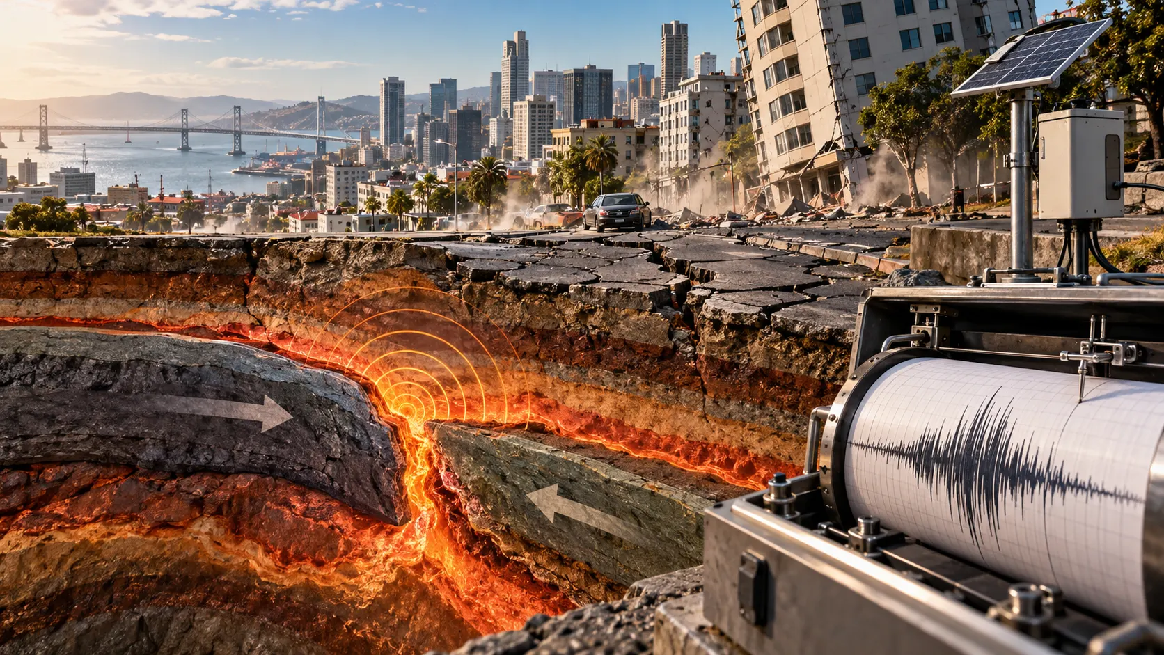
Earthquakes are among the most powerful natural events on Earth, capable of shaking the ground, damaging buildings, and changing landscapes within seconds. They can happen without warning, affecting communities in regions where Earth’s crust is constantly moving. Understanding why earthquakes occur helps explain the forces operating beneath our feet and why certain parts of the world experience more seismic activity than others.
Learning what causes earthquakes and how they are measured provides valuable insight into plate tectonics, seismic waves, earthquake magnitude, and ground shaking. Scientists use specialized instruments and measurement scales to understand earthquake strength, identify their locations, and assess potential damage. This guide explains the science behind earthquakes, how they are recorded, and what people can do to stay safer during seismic events.
What Is an Earthquake and How Does It Happen?
An earthquake is the sudden shaking of Earth’s surface caused by the release of energy within the planet’s crust or upper mantle. This energy usually builds up when large sections of rock experience pressure from moving tectonic plates. When the rocks suddenly slip along a fault, stored energy travels outward as seismic waves, producing the ground movement people experience during earthquakes.
Earth’s outermost layer consists of rigid sections called tectonic plates that move slowly over the underlying mantle. Although these movements typically occur at rates of only a few centimeters each year, they create enormous forces over time. Rocks along plate boundaries may become locked together, allowing stress to accumulate until sudden movement releases the stored energy.
Earthquakes vary considerably in strength, depth, duration, and geographical impact depending on the forces involved. Some produce vibrations so weak that people cannot feel them, while others generate intense shaking capable of damaging infrastructure. Scientists study these differences to understand seismic activity, improve earthquake-resistant construction, and identify regions where future earthquakes are more likely to occur.
How Tectonic Plate Movements Cause Earthquakes
Tectonic plate movement is responsible for most of the world’s significant earthquakes because Earth’s outer shell is divided into constantly moving sections. These plates interact along boundaries where they collide, separate, or slide past one another. Their movement creates stress within surrounding rocks, eventually producing earthquakes when accumulated pressure exceeds the strength of the rocks or friction holding them together.
At convergent plate boundaries, two tectonic plates move toward each other, sometimes forcing one beneath the other through a process called subduction. These areas can produce exceptionally powerful earthquakes because large sections of the plate boundary may become locked. When the accumulated stress is released, the resulting earthquake can affect extensive regions and sometimes generate destructive ocean waves.
Divergent boundaries occur where tectonic plates move apart, allowing new crust to form as material rises from beneath Earth’s surface. Transform boundaries develop when plates slide horizontally past each other, creating friction and sudden fault movement. Each boundary type produces different seismic patterns, helping geologists understand why earthquakes occur frequently in certain geographical locations.
What Are the Different Types of Earthquake Faults?
An earthquake fault is a fracture or zone of fractures within Earth’s crust where blocks of rock move relative to each other. Faults develop because tectonic forces stretch, compress, or push rocks sideways over long periods. Scientists classify faults according to the direction of movement, which helps explain the stresses responsible for different earthquake patterns.
Normal faults form when Earth’s crust experiences tension, causing one block of rock to move downward relative to another. Reverse faults develop under compression, forcing one block upward over an adjacent section. A low-angle reverse fault is commonly called a thrust fault, and large thrust faults can produce some of the strongest earthquakes recorded worldwide.
Strike-slip faults occur when blocks of rock move horizontally past one another rather than primarily upward or downward. The San Andreas Fault in California is a well-known example associated with this type of movement. Understanding these fault structures allows scientists to map seismic hazards, investigate historical earthquakes, and identify areas where significant stress may accumulate.
What Other Natural and Human Activities Can Cause Earthquakes?
Although tectonic plate movement causes most earthquakes, volcanic activity can also produce ground shaking. As magma moves through underground rock formations, it can create pressure that fractures surrounding material and generates seismic waves. These volcanic earthquakes sometimes provide scientists with useful information about changes occurring beneath active volcanoes before or during eruptions.
Some earthquakes occur away from major plate boundaries because existing faults can respond to stress within the interior of tectonic plates. Natural processes such as underground rock collapse may also generate smaller seismic events. These earthquakes demonstrate that ground movement does not occur exclusively near plate boundaries, although major tectonic fault systems remain the primary source of significant seismic activity.
Human activities can occasionally trigger earthquakes by changing underground pressure or stress conditions. Examples include wastewater injection, some geothermal operations, mining activities, and the filling of large water reservoirs under particular geological conditions. These events are known as induced earthquakes, and scientists investigate them to understand how industrial operations can influence existing underground faults.
Where Do Earthquakes Start and How Do Seismic Waves Travel?
An earthquake begins at a location underground called the focus, also known as the hypocenter, where fault movement first releases seismic energy. The point directly above it on Earth’s surface is called the epicenter. Scientists use these locations to describe where an earthquake started and investigate how its depth and distance influence shaking experienced by nearby communities.
When an earthquake occurs, seismic energy travels through Earth in several types of waves, including primary waves and secondary waves. Primary waves, commonly called P-waves, travel faster and can pass through solids and liquids. Secondary waves, or S-waves, move more slowly and travel through solids, producing a different type of ground motion as they pass.
Surface waves travel along Earth’s exterior and can create significant horizontal and vertical ground movement during large earthquakes. The intensity of shaking depends on several factors, including earthquake magnitude, depth, distance, and local ground conditions. Studying wave behavior helps scientists locate earthquakes, understand Earth’s internal structure, and estimate the effects of seismic events.
How Are Earthquakes Measured Using Seismographs?
Scientists measure earthquakes using sensitive instruments called seismometers, which detect and record ground movement caused by seismic waves. The recorded information is commonly displayed as a seismogram, showing changes in ground motion over time. A seismograph refers to the recording system, and these instruments help researchers identify earthquakes that may be too small for people to notice.
Modern seismic monitoring stations operate across many regions, continuously measuring vibrations generated by earthquakes and other sources. When seismic waves arrive, instruments record their motion and precise arrival times. Scientists compare measurements from different stations to estimate the earthquake’s location, depth, and magnitude while distinguishing seismic activity from unrelated ground vibrations.
The time difference between arriving P-waves and S-waves helps scientists estimate the distance between a monitoring station and an earthquake. Combining information from several stations allows researchers to determine the earthquake’s epicenter more accurately. These measurements support seismic research, earthquake monitoring networks, and public information systems that report significant earthquakes shortly after they occur.
What Is Earthquake Magnitude and How Is It Calculated?
Earthquake magnitude describes the overall size of an earthquake using a numerical scale based on measurements of seismic activity. Unlike the level of shaking felt in individual locations, magnitude represents the size of the earthquake at its source. Scientists calculate magnitude from instrument recordings using methods suited to the earthquake’s size, distance, and available geological information.
The Richter scale, developed in the twentieth century, became widely recognized as a method for measuring earthquake magnitude. Its original form was designed for particular earthquake recordings in Southern California rather than all earthquakes worldwide. Modern seismologists generally use other magnitude calculations, especially for large earthquakes that exceed the reliable measurement range of the original Richter method.
The moment magnitude scale, represented by Mw, is commonly used to describe moderate and large earthquakes. It estimates earthquake size using seismic moment, which relates to fault area, movement, and rock rigidity. Each increase of one magnitude unit represents approximately thirty-two times more energy release, demonstrating why relatively small numerical differences can indicate substantially larger earthquakes.
What Is the Difference Between Earthquake Magnitude and Intensity?
Earthquake magnitude and intensity describe different aspects of seismic events, although people frequently use these terms interchangeably. Magnitude measures the overall size of an earthquake at its source, while intensity describes the shaking and effects experienced at a specific location. Understanding this distinction explains why communities affected by the same earthquake may report very different levels of damage.
The Modified Mercalli Intensity Scale is commonly used to describe observed earthquake effects using twelve levels, represented by Roman numerals. Lower levels correspond to shaking that may barely be noticeable, while higher levels indicate increasingly severe effects on structures and surroundings. Intensity assessments consider human observations, building damage, and other evidence of ground shaking.
An earthquake has one reported magnitude value for a particular magnitude method, but its intensity varies across affected locations. Communities near the source may experience stronger shaking than distant areas, although local soil conditions can change this pattern. Consequently, scientists examine both magnitude and intensity when assessing earthquake impacts and communicating seismic hazards to the public.
What Factors Determine How Much Damage an Earthquake Causes?
Earthquake damage depends on several interacting factors rather than magnitude alone. The depth of the earthquake, distance from the fault, duration of shaking, and type of ground beneath buildings can strongly influence the outcome. A relatively moderate earthquake near a populated area may cause serious problems, while a larger earthquake in a remote region may cause limited damage.
Local geological conditions play a significant role because loose sediments can amplify ground movement compared with some firmer rock formations. Saturated soils may also experience liquefaction, a process in which shaking causes soil to temporarily lose strength. This can damage building foundations, roads, and underground utilities, creating additional hazards beyond the movement caused directly by seismic waves.
Building design, construction quality, and community preparedness also influence the consequences of earthquakes. Structures designed according to appropriate seismic standards generally perform better than vulnerable buildings lacking reinforcement or suitable foundations. In coastal areas, strong undersea earthquakes may also trigger tsunamis, making public warning systems and safe evacuation planning particularly important for reducing disaster risks.
Can Scientists Predict Earthquakes Before They Happen?
Scientists cannot currently predict the exact time, location, and magnitude of future earthquakes with reliable accuracy. Although researchers understand many geological processes responsible for seismic activity, the behavior of underground faults remains extremely complicated. Small changes in stress and rock conditions can influence earthquake occurrence, making precise short-term predictions beyond the capabilities of current scientific methods.
Instead of predicting individual events, scientists assess earthquake probabilities and seismic hazards over longer periods. They study fault movement, historical earthquake records, geological formations, and patterns of seismic activity to estimate potential risks. These assessments help governments, engineers, and communities make informed decisions about building regulations, emergency planning, and infrastructure development in earthquake-prone regions.
Earthquake early warning systems provide a different form of protection by detecting an earthquake after it begins and sending alerts before strong shaking reaches some locations. These systems use rapidly arriving seismic information to estimate potential danger. Depending on distance and communication delays, warnings may provide seconds of notice, although people close to the epicenter may receive little or none.
How Can You Stay Safe During an Earthquake?
Earthquake safety begins with understanding your surroundings and preparing before an emergency occurs. Secure heavy furniture when possible, identify safer places inside buildings, and learn the recommended procedures for your location. Keeping emergency supplies accessible and discussing a family communication plan can also help reduce confusion when unexpected ground shaking disrupts normal activities.
During strong shaking, people indoors are generally advised to drop to their hands and knees, take cover beneath a sturdy table or desk, and hold on until the shaking stops. Stay away from windows and objects that might fall, and avoid rushing outside while the ground is moving. People outdoors should move away from buildings and overhead hazards when they can do so safely.
After an earthquake, remain alert for aftershocks and follow instructions issued by local emergency authorities. Avoid entering visibly damaged buildings, watch for hazards such as broken glass or damaged electrical equipment, and seek assistance when needed. In coastal areas, strong or prolonged shaking may signal tsunami danger, making immediate movement toward higher ground or inland locations essential when advised.
Conclusion
Earthquakes occur primarily because tectonic plates move and create stress within Earth’s crust, eventually causing sudden movement along geological faults. Other processes, including volcanic activity and certain human operations, can also trigger seismic events. Understanding these causes helps explain why earthquakes happen, where they are most common, and how seismic energy travels through the planet.
Scientists measure earthquakes using seismometers, seismic wave recordings, magnitude calculations, and intensity assessments. Modern moment magnitude measurements describe earthquake size, while intensity scales explain how shaking affects individual locations. Together, these measurements provide valuable information for geological research, earthquake engineering, emergency planning, and assessments of potential damage.
Although scientists cannot reliably predict exactly when an earthquake will happen, continuous monitoring and better understanding of seismic hazards can help communities prepare. Stronger buildings, practical safety planning, public education, and early warning systems contribute to reducing earthquake risks. By learning the science behind earthquakes and their measurement, people can better understand these natural events and respond more confidently when they occur.
Frequently Asked Questions
What Is the Main Cause of Earthquakes?
Most earthquakes occur when tectonic plate movements create stress along geological faults. When rocks suddenly slip, stored energy is released as seismic waves that travel through Earth and cause ground shaking.
What Instrument Is Used to Measure Earthquakes?
Scientists use seismometers to detect and measure ground vibrations caused by earthquakes. These instruments generate seismic recordings that help researchers calculate earthquake magnitude, locate epicenters, and study seismic wave behavior.
What Is the Difference Between the Richter Scale and the Moment Magnitude Scale?
The Richter scale was originally developed using seismic wave amplitudes for specific regional earthquakes. The modern moment magnitude scale estimates earthquake size using seismic moment and is more suitable for measuring large earthquakes.
Can Earthquakes Happen Without Warning?
Yes, earthquakes can occur without noticeable warning because scientists cannot reliably predict their exact timing. Early warning systems may detect earthquakes after they begin and provide brief alerts before strong shaking arrives.
Which Countries Experience the Most Earthquakes?
Countries along active tectonic plate boundaries, including Japan, Indonesia, Chile, and the Philippines, experience frequent earthquakes. These regions are associated with the Pacific Ring of Fire, an area of extensive seismic and volcanic activity.